
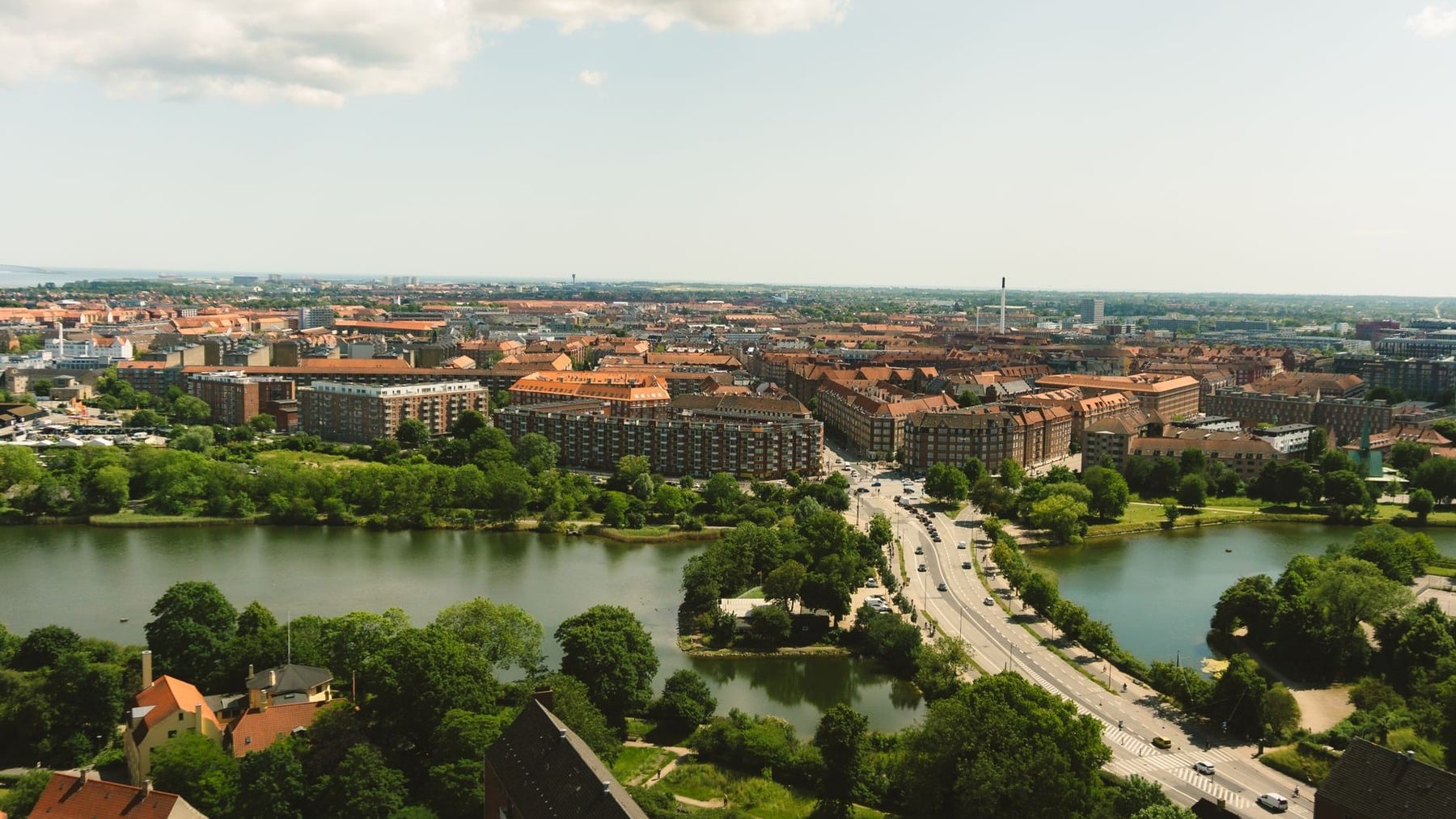
Copenhagen’s most famous piece of urban planning began with a picture simple enough to understand before reading a page of policy. The compact city was a palm. Five railway corridors spread across Zealand as fingers. New housing and local centres would gather around stations, while the land between the fingers would remain green.
The Regional Planning Office for Greater Copenhagen published the proposal in 1947 under the less memorable title Sketch Proposal for a Regional Plan for Greater Copenhagen. A hand drawn across the cover supplied the nickname that survived. Nearly eight decades later, the metaphor remains visible in both the metropolitan landscape and Denmark’s formal planning framework.
The resemblance should not be made too perfect. The original document was a sketch proposal, not a binding master plan for every future street. Today’s region has extra rail axes, orbital links, infill and development on Amager that the five-finger image does not neatly contain. Its longevity is the story of a principle repeatedly adapted, not one drawing copied without interruption.
A cover image turned a regional proposal into the Finger Plan
The Danish Architecture Center describes the Finger Plan as Denmark’s first urban development plan for Greater Copenhagen. Prepared by the Regional Planning Office and published in 1947, it concentrated anticipated growth along five main transport corridors extending from the existing city. The centre became the palm, the corridors the fingers and the unbuilt land between them green wedges.
That clarity concealed a difficult regional problem. Copenhagen was expected to expand beyond municipal boundaries after the Second World War. Housing, employment, rail investment, roads, sewers and open land could not sensibly be planned as separate local questions. The hand gave different authorities a common picture of where expansion should go.
The plan was never formally adopted in its original form. Its influence came through broad political and professional agreement, the 1949 Urban Regulation Act, subsequent regional plans and the practical sequence of railway and suburban construction. It offered a durable framework without predicting every district that would eventually appear.
Railway stations were meant to hold suburbs like beads
The metaphor was visual, but the operating idea was transport. Rather than permit Copenhagen to spread in one continuous ring, planners directed new districts along radial railway lines. Stations would anchor housing, shops and local services, connecting residents to employment in the palm.
The US Geological Survey’s Earthshots account describes the intended pattern as suburbs linked like “beads on a string.” Each bead could have a local centre, while the railway supplied the string. This was an early form of what is now called transit-oriented development, though applying the newer label can make the post-war plan sound more contemporary than it was.
The original five were directional corridors rather than the exact modern S-train service map. Today’s network has more branches and service patterns than a hand has fingers. What persisted was the location rule: metropolitan growth should generally cluster near high-capacity public transport instead of being scattered evenly across the countryside.
The green wedges were infrastructure too
The spaces between the fingers were not decorative leftovers. The 1947 proposal intended them for agriculture, forests, paths and regional recreation. Keeping them substantially free of urban development would give suburban residents access to open land and stop neighbouring fingers from merging into one broad field of construction.
This is the part of the diagram that can disappear when the Finger Plan is reduced to a clever transit map. Its organising unit was the relationship between a built corridor and an open wedge. The city shape depended as much on where planners withheld development as on where they encouraged it.
Scandinavia Standard’s earlier brief look at urban planning in Copenhagen places the plan within a wider history of shaping streets, public space and movement. The green wedges enlarge that view from city blocks to a metropolitan landscape, where agriculture and recreation were treated as regional land uses rather than future building reserves.
Protection has never meant that every hectare is untouched nature or equally accessible parkland. The wedges include farmland, recreational facilities, protected areas and other uses. Their planning function is primarily to resist urbanisation and retain an open regional structure.
Satellite images show the fingers, but only approximately
The most striking evidence comes from the USGS Landsat series. Its false-colour images from 1985, 1994, 1998, 2001 and 2014 render developed land in purple shades, with water dark and vegetation separating the urban bands. The agency’s own measured description is that the five fingers and hand are “vaguely recognisable.”
That wording matters. The image does not show five crisp, equal lines copied from the 1947 cover. It shows a dense palm with development radiating outward along several corridors, interrupted by greener spaces. The Køge direction is long and narrow, northern growth is more complicated, and cross-connections soften the spaces between fingers.
The official USGS comparison ends in 2014, not 2026. More recent satellite and settlement maps still make the broad radial form legible, but simply recognising a hand is not a quantitative test of causation. Geography, earlier railways, later infrastructure and market demand also shaped the city. The fair conclusion is that the plan helped preserve and reinforce a form that remains visible, not that it created every pixel.
The 1947 sketch eventually became a binding planning framework
Finger Plan principles moved through a succession of regional plans before the state issued a national planning directive in 2007. The current Danish planning authority overview says Finger Plan 2019 governs 34 municipalities, home to just over two million people. Their municipal and local plans must follow its provisions, principles and mapped designations.
The modern structure divides Greater Copenhagen into four broad planning geographies: the inner metropolitan palm, the outer city fingers, the green wedges and the remaining metropolitan area. The official Finger Plan 2019 guidance links urban development to railways, S-trains, regional trains, metro, light rail and the main road network, while land between the fingers is primarily reserved for regional recreation and agriculture.
This framework is current but not static. Denmark’s planning authority began revising Finger Plan 2019 in March 2025. Its stated focus includes station proximity, new business and infrastructure needs, and how the recreational values of the green wedges are used. As of August 2026, the authority still identifies the 2019 plan as the applicable directive while the revision proceeds.
The modern hand has extra joints, crossings and blurred edges
Contemporary Copenhagen cannot be understood as five isolated commuter branches. Development on Amager and in Ørestad added a major urban axis outside the original hand. The metro, ring roads and light rail connect across radial lines. Employment is no longer confined to a single central palm, and everyday trips do not all point towards the historic centre.
Even the fingers have changed proportions. The Danish Architecture Center notes that the Køge thumb became unusually long and thin, while urban development has blurred some northern gaps. Current planning maps name rail corridors reaching Helsingør, Hillerød, Farum, Frederikssund, Roskilde and Køge, as well as Amager. The neat count of five is now a founding diagram rather than a literal inventory of every growth axis.
This flexibility helps explain the plan’s survival. A rigid picture would have broken as the city changed. A regional rule about concentrating development near transport and retaining green separation could absorb new lines, new centres and revised boundaries while preserving its basic spatial logic.
The enduring achievement is therefore not a capital frozen in the shape of a perfect hand. It is a metropolitan argument that remains readable from above: build in connected corridors, leave meaningful open wedges between them, and treat the map of what stays unbuilt as seriously as the map of what grows.