
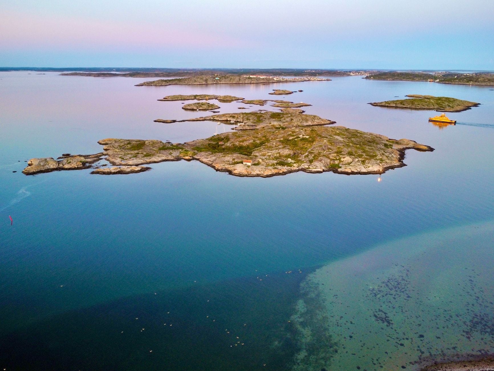
Stockholm makes Sweden’s island geography unusually easy to see. Water divides the centre into named pieces, bridges join them, and ferries pass through the gaps. The familiar description of a capital built on 14 islands is accurate, but it barely begins to explain the national map.
Statistics Sweden counted 267,570 islands in its 2013 inventory, published on 8 December 2014. International lists assembled from national figures place Sweden above Norway, Finland and every other country. The number is official. The ranking needs one qualification: countries do not all define and map islands in the same way.
Sweden’s total is the result of a precise mapping rule
The Statistics Sweden inventory used the water layer in Lantmäteriet’s real-estate map, drawn at a scale of 1:10,000. Land completely enclosed by that mapped water became an island in the statistics. The smallest included areas measured just nine square metres.
The rule goes beyond the everyday image of a rocky shore surrounded by sea. It includes islands in lakes and large watercourses, artificial islands and land surrounded by artificial water. Statistics Sweden gives examples including pond islands, some piers, castles fully encircled by moats and land separated by a dug canal.
That breadth is not a flaw hidden in the count. It is the definition that makes the figure reproducible. It also explains why 267,570 should not be imagined as a list of places large enough to visit, name or build on. The reference year is 2013, so the total is an official snapshot rather than a live counter of a changing landscape.
The world ranking is real, but it is not an equal global census
A 2025 Condé Nast Traveler comparison of national totals ranks Sweden first with 267,570, Norway second with 239,057 and Finland third with 178,947. On those official counts, the claim that Sweden has more islands than any other country holds.
There is no single worldwide survey that has applied Sweden’s nine-square-metre minimum, treatment of inland water and rules for artificial features to every country. Mapping resolution matters too. Japan’s Geospatial Information Authority raised its official count from 6,852 to 14,125 after a digital resurvey in 2023, a useful reminder that an island total can change when the map improves even if the coast itself does not.
The careful formulation is therefore the one in the title: Sweden leads by its own official count when national inventories are placed side by side. It would be stronger than the evidence to claim that every island on Earth has been measured consistently and Sweden has won an exact physical contest.
Nearly two-thirds of the islands are not at sea
The word archipelago usually suggests an ocean horizon scattered with rock. Sweden’s count is more extensive because it follows water inland. Statistics Sweden recorded 102,893 sea islands and 164,677 islands in lakes and large waterways. Marine islands made up 38 per cent of the total, leaving roughly 62 per cent inland.
Most were also very small. A later official shoreline summary from Statistics Sweden reported that 71 per cent had less than 1,000 square metres of land. Only 8 per cent were larger than one hectare.
The islands together covered about 1.21 million hectares, or 12,112 square kilometres, equivalent to 3 per cent of Sweden’s land area. That total spans very different geographies. Gotland, the largest, covered nearly 3,000 square kilometres. At the opposite end sits a vast inventory of islets and skerries that can disappear into the visual texture of a lake or coast.
Fewer than four islands in every thousand had permanent residents
Only 984 islands were populated in the 2013 data. That is about 0.37 per cent of the official total, or fewer than four in every thousand. Just over 8,000 had any recorded buildings, including structures that were not homes.
“Uninhabited” therefore covers a wide range. It can mean a substantial forested island without a registered resident, a rock used by nesting birds, a tiny patch in an inland lake, or a shore fragment newly distinct at the map’s resolution. It should not be read as 266,586 abandoned settlements.
The populated total is shaped by some very large and urban islands. Statistics Sweden noted that its definition treats all of Södertörn and parts of Nacka as an island. On that basis, more than half of Stockholm County’s population lived on islands in the 2013 inventory. A bridge can make island life feel indistinguishable from the mainland while the water boundary remains clear to the mapping system.
Stockholm’s 14 islands sit inside several larger frames
Visit Stockholm describes the city as built on 14 islands and places more than 30,000 islands in the archipelago beyond. Those numbers are not rival answers to the national total. They describe different geographic frames.
The 14 are the recognisable pieces of the central city. The archipelago figure reaches outward through the Baltic approaches. Statistics Sweden’s 267,570 covers the entire country, including islands in freshwater and small features that a regional travel map would have little reason to label.
Even Stockholm County is not the numerical centre of the story. Norrbotten had the most islands in the 2013 inventory, followed by Stockholm and Västra Götaland. The national pattern runs through northern lakes, the Gulf of Bothnia, the Stockholm skerries, the west coast and the country’s many rivers and reservoirs.
The landscape was shaped by ice and is still changing
The number is partly about Sweden’s careful mapping, but the fragmented terrain is physical. The Geological Survey of Sweden describes a country built largely on old crystalline bedrock, with surface deposits formed through repeated periods of glaciation and deglaciation. Ice carved, pressed and deposited material across an already varied landscape.
When the last ice sheet retreated, the crust began rising as the load disappeared. The process continues. The Swedish Meteorological and Hydrological Institute says postglacial land elevation still affects the apparent sea level around the coast, with the fastest uplift in northern Sweden.
In shallow northern waters, uplift can expose new land, enlarge islands and eventually join them to one another. Bays can narrow into lakes. The total does not simply rise forever, because separate islands can also merge or become attached to the mainland. Scandinavia Standard recently examined how this postglacial rebound is redrawing parts of the Scandinavian coast.
Stockholm’s 14 islands are easy to notice because streets, bridges and buildings give them edges. Most of Sweden’s official total are smaller, inland, unbuilt and absent from ordinary travel maps.